

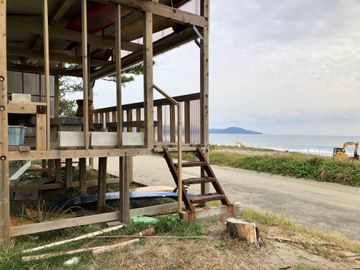
 Structure is mostly exposed
Amenities & Facilities
Key Distances & Elevations

Reviews
 Stephen .Member
General Description:
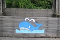
Positioned about 31.5 km from Iwamotoji (T37), it is located along National Highway No. 56, near Umi-no-Omukae Station on the Tosa Kuroshio Railway, Nakamura Line.
The hut is a stilt type to bring it up to the level of the road surface. Located facing the Pacific Ocean, it has the form of a whale. If you sit on its benches, you can see the Pacific Ocean over the national highway.
2/10/2019 Comments:
On the edge of Highway 56 and in a car park. This is a potentially busy site. It is in a mildly built up area, there are nearby houses, so it is not isolated. Due to the hut’s open structure it would be an excellent rest spot on a summer afternoon, shady with a sea breeze. It may be draughty and damp in wind and rain.

Weather
Humidity
UV Index
Daylight
Places Nearby

Nada Park
灘公園
Idakanon Temple
伊田観音寺
Tosa Utopia Country Club
土佐ユートピアカントリークラブ
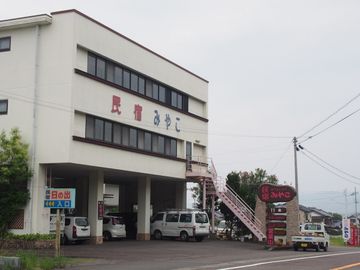
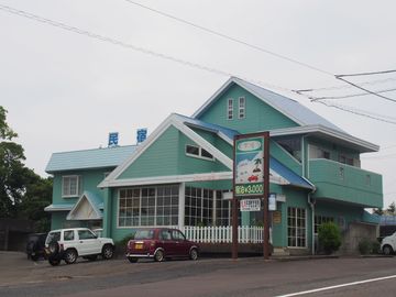
Minshuku Miyako
民宿みやこ
Hinode Minshuku
民宿日の出
Big Marine
民宿ビッグ・マリーン
Inosaki Hot Spring
井ノ岬温泉
Biosu Ogata Michi no Eki
道の駅ビオスおおがた
Kuroshio Stay
黒潮の家
Irinomatsubara Camping Ground
入野松原キャンプ場

Takahama Minshuku
民宿たかはま
Uchidaya
内田屋
Kaiseimaru Minshuku
漁家民宿 海生丸
Shiratagawa Minshuku
民宿しらたがわ
Umibozu Hotel
海坊主
Tosa Seinan Great Park
土佐西南大規模公園