Finding Your Way in Shikoku
Walking Shikoku as a Pilgrim
Dressing as a henro (pilgrim) and interacting with the people of Shikoku is truly a one-of-a-kind experience. The Shikoku Pilgrimage plays a significant part in the culture of Shikoku, and it’s not uncommon for pilgrims to be shown respect by strangers.

The majority of “aruki henro” (walking pilgrims) walk alone. You will occasionally encounter another pilgrim on the route and the two of you will decide to walk together, but it is not unusual or impolite to split ways after a few hours or days. We all walk at at different pace.
Walking alone is, for the most part, safe – especially on the peaceful island of Shikoku. Needless to say, you should still exercise common sense. Know the emergency number (119) before you start walking, and always have some coins in case you need to ues a phone booth.
Women pilgrims are not uncommon, albeit fewer in numbers compared to men. Although it is generally safe to walk the trails as a woman, Shikoku locals often strongly advise against women sleeping out, camping alone, or accepting free overnight stays at unverified places.

I once arrived at a shrine in the evening while walking with two other pilgrim friends. There we found a few fairly disheveled people who said they were planning to spend the night at the shrine. I learned that they were called shokugyō henro (職業遍路), or “career pilgrims,” which in essence means they are homeless. If I wasn’t traveling with two other pilgrim friends, I would not have stopped at the shrine.
Pacing Yourself
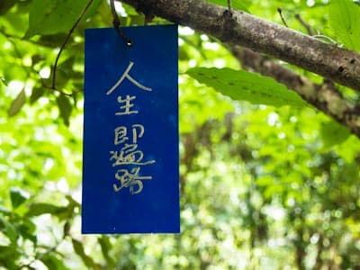
A pilgrim’s journey around the island of Shikoku is said to be a symbolic representation of that person’s journey through life. There is even a saying –「人生即遍路」( “Life is a pilgrimage”). For many pilgrims, walking alone is the only way to fully comprehend the meaning of the pilgrimage. Just as we experience life in our own idiosyncratic ways, each pilgrim’s pace is unique.

Some walk the pilgrimage with a deadline, while others may have set aside their obligations and responsibilities, and so are able to just go with the flow. Some will only visit the 88 temples, while others are on a mission to also visit all the bekkaku/bangai temples. Some will go at a consistent pace, while others choose to bolt ahead, rest for a day, then take off again.
When I first started my pilgrimage, I met a French guy who had come to Shikoku right after completing the Camino de Santiago. While my body was aching and blistering, he was already swole, and trotted along at a pace of more than 30km per day from the beginning.
Pilgrims walk at different paces. Many do the whole thing slowly. There is nothing wrong with taking your time, and you should try not to race others.
How long does it take to walk a route?
The average speed adults walk on flat land is about 5 kilometers per hour, or 3.1 miles per hour. On moderate hiking trails, your speed can decrease to about 3 kilometers per hour. On very steep trails, your speed may decrease to only 1 kilometer per hour. You can use elevation maps, such as those generated on our place pages, to better determine your pace at different sections, and how long it will take you to get to your destination each day.

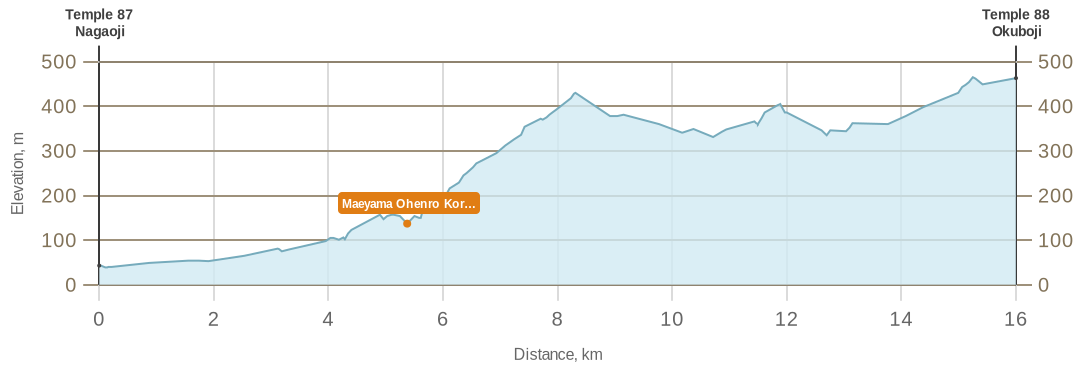
The “Key Distances and Elevations” section shows estimates on how long it takes to go from the temples to a location on the main route. Walking times are estimated with a modified approach to Naismith’s rule to account for elevation changes, slope angles, and other practical considerations that require a more conservative bias. On the Shikoku Pilgrimage, for example, most walkers carry a heavy backpack, which can slow them down drastically, especially when walking uphill. As part of our approach to overestimating, the basis of our calculations assumes a speed of 4 kilometers per hour on flat land. Even though most formulas do not account for elevation drops, we add slightly more time to paths that are downhill.
Estimating hiking times automatically is difficult. In real life, hiking times greatly vary from person to person. Different terrains and changing weather conditions cannot be easily factored into automated calculations. As you walk the pilgrimage, you can compare your pace to ours or other maps’ estimates, and adjust your own estimates going forward.
How do I plan for each day?
Pilgrims typically walk between 20-40 kilometers (12.4-24.9 miles) per day, and take between 30-60 days to complete the full pilgrimage of the 88 main temples. Taking into account mealtime, breaks, and potential detours, this comes out to roughly 9-12 hours of walking each day. There are many who don’t walk a full day either, choosing to walk in the mornings and enjoy the rest of the day with other activities, for example.
Most pilgrims begin walking each day early in the morning, at about 5-6am, to take full advantage of daylight. Be aware that this may be much earlier than standard breakfast times at minshuku or ryokan. After a full day of walking, most arrive at their place of lodging by 3-5pm, right in time for a cozy bath and a hearty dinner. Dinners at minshuku or ryokan typically start at 6-7pm. If you plan on walking long hours, make sure that you let inn owners know beforehand if you plan to arrive later than dinnertime. More importantly, you should bring along headlights for visibility and reflective clothing or gear. Be aware that if you plan on going in the winter, daylight hours will be relatively short.
As someone who was not accustomed to trekking, I was only able to realize my comfortable pace about a week into the pilgrimage. As I started paying close attention to time and the distances I’d walked, my body developed a natural clock – I was able to tell approximately how much time had passed without looking at maps or my wristwatch!
When considering pace and making an itinerary, it is important to keep in mind that temple opening hours are from 7am to 5pm. This means that however you plan your days, you should aim to arrive at the last temple by 5pm.
Sometimes, pilgrims are forced to take a day or half day off due to uncontrollable circumstances like heavy rainfall or typhoons. You should always check the weather forecast and consider whether it will affect the types of routes you are planning on for the day, such as steep mountain trails that have experienced rainfall on the day before or the day of. Sometimes, it is also necessary to pause due to exhaustion, illness, or just to recover. Breaks are a great way to reset your body to perform even better afterwards, especially if you are not an experienced trekker.
It is normal for pilgrims to take rest days. I met a very fit pilgrim who would walk about 45-60km per day (basically a jog!) for a few days at a time. Afterward, he would stop walking altogether for 2-3 days to copy the Heart Sutra by hand with a calligraphy pen. He repeated this process throughout his entire pilgrimage. There were a few times where I had surpassed him by dozens of kilometers, only to magically bump into him on the trail again in 2 days.
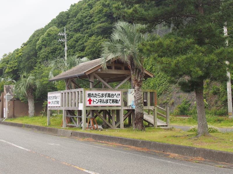
Japan has built quite a few of these tsunami evacuation towers, particularly along coastlines and low-lying regions. If you find yourself in the middle of a typhoon, try to spot one of these and get in there. Some of them may be recorded on our map.
The Shikoku Pilgirmage Routes

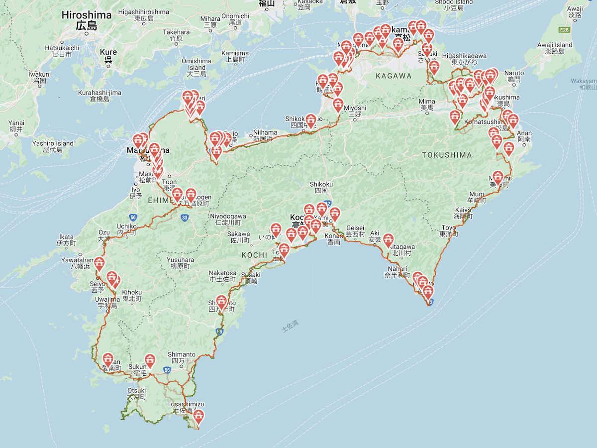
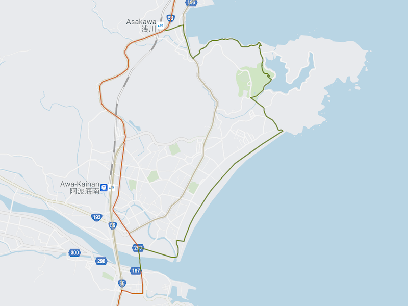
Different guidebooks and maps of the pilgrimage may have slightly differing routes, and they are revised and changed every now and then. There are many routes connecting the 88 main temples, and sometimes other temples as well. There are no right or wrong routes. All paths that take you through the Shikoku Pilgrimage temples are considered the Shikoku Pilgrimage.
There are three general categories of pilgrim paths – main, alternative, and scenic/historical routes. Our interactive map has a decent coverage of these routes between the main temples. Depending on whether you are only visiting a portion of the main temples, the main temples plus bekkaku temples, or any additional bangai temples and inner sanctuaries, you will have to choose the right map for your pilgrimage goals. Our map is a digital aid for routes (with a current location finder), temples, lodging, and other places. We also have elevation maps on place pages. We recommend that you also bring a physical map with you in case you lose signal in remote areas or run out of battery.
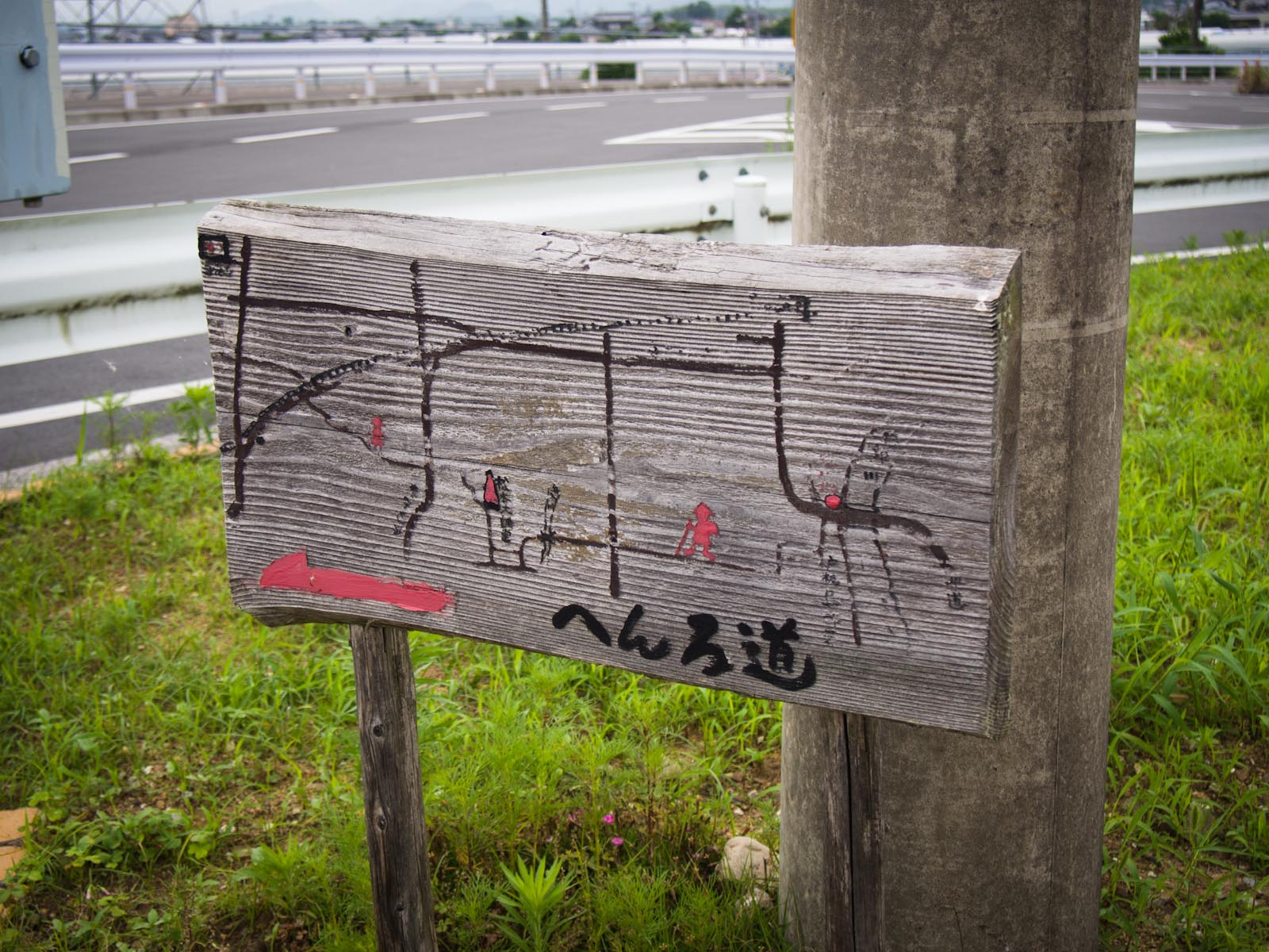
Along the trails, you will find many signs, sticker, and posts that can help you navigate. As they can indicate different paths and alternative paths, it is important to understand and distinguish what they are.
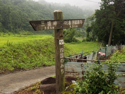
Roads of Shikoku (Shikoku no Michi)
The Roads of Shikoku (Shikoku Nature Trail), or Shikoku no Michi (四国のみち) are a network of nature trails spread across Shikoku that spans over 1545.6 kilometers, or 960.4 miles. These “courses” are categorized into historical trails designated by the Ministry of Land, Infrastructure, Transport and Tourism (MLIT), and nature/scenic trails designated by the Ministry of the Environment (MOE).
Certificates are available upon completing Shikoku no Michi routes. The prefectural certificate is given to those who have completed all routes in one prefecture. Simply take a picture of yourself at each designated shooting point along each course, then submit your personal information and dates of shooting to the corresponding prefectural department. If you have obtained a certificate from each of the four prefectures, you can apply to obtain a Certificate of Completion for all routes in Shikoku.
The routes and the latest information on trail conditions and changes are officially published here. Many of the scenic trails pass through large natural parks for a completely immersion in nature, or are along coastlines with breakthtaking views of the ocean.
The Shikoku no Michi trails will sometimes overlap with the main pilgrim paths, or offer a detour while still taking you on the way to a temple. Many of these are identified in our map and other maps and guidebooks. It is important to remember that not all Shikoku no Michi trails are pilgrim paths! If you follow them without paying attention to your map, you may go down the wrong path. The MLIT and MOE will sometimes make revisions and changes to these routes upon new research or new development in the area, so it is best to make sure you have the latest guides and maps.
Many pilgrims plan their journey around going on some Shikoku no Michi trails, so that they can spend more time in nature or visit historically significant spots. If you have spare time on the pilgrimage, we recommend you try out a few!
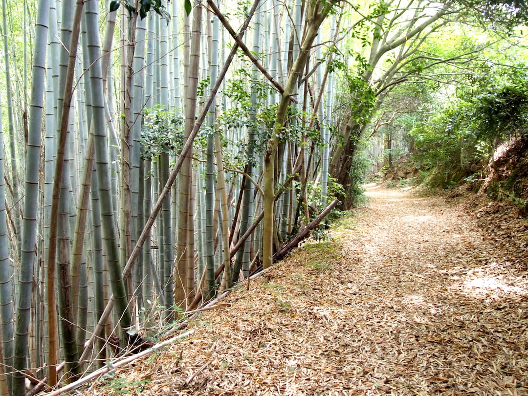
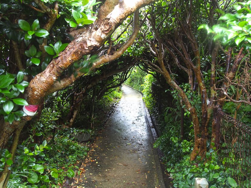
Pilgrim Paths (Henro Michi)
Henro Michi (遍路道) are routes that lead pilgrims to the sacred sites of the Shikoku Pilgrimage. Signs, stickers, and posts can be found all along the pilgrimage trails to help pilgrims find their way. Similar to Shikoku no Michi, not all trails labeled “遍路道” lead to the right place. The sacred sites include not only the main 88 temples, but also the 20 bekkaku temples, bangai (other) temples, and inner sanctuaries. It can also indicate paths to other pilgrimages in Shikoku.


Some of the Henro Michi are “Old Henro Michi,” meaning they are roads that are believed to have originally been walked by Kukai himself, but have collapsed or become overgrown so that they are not in use anymore. Local governments and organizations will sometimes restore these routes so that pilgrims can experience a more “authentic” way of doing the pilgrimage again.
Choosing Your Routes

Some of the alternative routes will take you through busier parts of town, where you can stock up on food and supplies, other routes like the Roads of Shikoku allow you to take a detour to learn about the history of the pilgrimage or enjoy views of the ocean or mountains. In choosing your routes, you may consider the following factors:
- Time: How many days do you have to cover the length of your chosen portion or temples of the pilgrimage?
- Physical capacity: Mountain trails may sometimes be shorter, but if you are struggling with blisters or other ailments, you might want to take the longer paved road path that doesn’t put as much strain on your body.
- Purpose: What do you hope to see or accommplish on the pilgrimage? If you want to complete the entire 88-temple routes in the shortest amount of time possible, you may want to stick with the main (or shortest) paths. To experience more than just walking the pilgrimage, you may consider looking at the “Shikoku no Michi” routes to visit historical sites or research nearby places to take a detour and sightsee, such as Tebajima Island in Tokushima.
- Weather: Always pay attention to weather forecasts. When there is recent or upcoming heavy rainfall, we strongly discouraging you from walking deep in the mountains on steep trails. Coastlines and areas with trees are generally not safe during typhoons either.
- Other needs
- Do you need to stock up on hiking or biking supplies? If you skip going through a large city center, you may not be able to find a large enough selection of what you’re looking for.
- Do you need a meal at a certain time of the day? If your place of accommodation doesn’t provide meals, you may need to head to the next town or city center first thing in the morning.
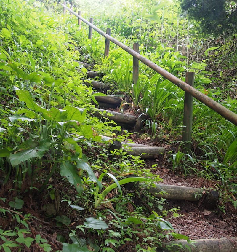
Henro Korogashi Sections
Henro korogashi (遍路ころがし), meaning “where pilgrims fall,” are particularly difficult trail sections of the Shikoku Pilgrimage. All walking pilgrims completing the entire pilgrimage will surely encounter a good number of them. They are found on the way to these main temples:


When traversing these difficult parts of the trail, you may be able to find lodgings or businesses at the beginning of the trails to take care of your luggage or bicycle. Most of them will hold your gear until you return, but some of them offer delivery services so that you can receive them at your lodging of the night. Always ask the innkeepers even if online platforms claim that they provide this service.
Taking Care of Accommodations
Most pilgrims plan their routes 1-3 days ahead and arrange their accommodations according to how far they will walk each day. During busy season in Spring and Autumn, we encourage you to book further ahead, especially in busy towns. If you book too far ahead, you risk overestimating or underestimating how far you planned on walking each day to arrive at your accommodation. If you book too last-minute, you risk not being able to find vacancies in nearby lodgings. How far you book ahead will greatly depend on the season, the number of lodgings available ahead of you, your confidence in knowing your pace, and your risk tolerance.
If you are running out of time by the end of the day, consider the option of taking a train or bus to your destination for the night, then back to the station you left off at to continue your walk the next day. Also, note that some hotels or inns may offer a ride from the closest pilgrim route or a train station or bus stop. If you will need a ride, please let them know at least a day before so that they have time to arrange for it.
Using Signs
Signs for Walking Pilgrims
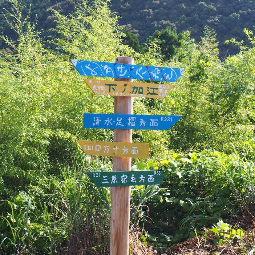
Throughout the pilgrimage route, you’ll occasionally find stone or wooden pillars carved with road/path names or directions. You will also see hundreds of hand-written / hand-carved signs and stickers, usually found in residential areas or stuck to trees and branches along mountain trails.
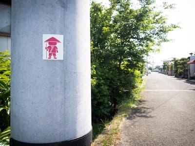
Although these are all signs that are useful for pilgrims, not all signs will lead to where you’re going. Make sure that you understand what “Henro Michi (遍路道)” and “Shikoku no Michi (四国の道)” mean, and use your map to cross-reference them. It may be a good idea to acquaint yourself with the kanji for numbers and other common characters, like those for temple or bathroom.
Road Signs
Road signs to the temples are provided for driving pilgrims and general tourists. They usually begin showing up a few kilometers out from the temples. Road signs for cities and attractions are a great way to make sure you’re heading in the right direction, especially as you approach prefecture borders. Since they are easy to spot and come with English translations, they can be quite useful to foreign pilgrims.
Kilometer markings on the sides of roads, usually highways, indicate how far you are from a particular city (or the distance you’ve covered between the markings). They are subtle and can be difficult to spot, but are very precise and accurate. Pilgrims often find them useful when pacing themselves to ensure they arrive at a temple before closing time.
Rest Areas and Huts
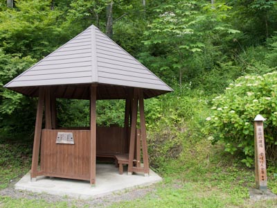
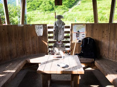
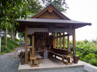
Many locals in Shikoku and various organizations have dedicated themselves to building and maintaining rest areas along the pilgrim path. These structures, typically provided at no cost to the pilgrim and at great cost to the builders, are a grand form of osettai.
Rest stops come in many forms, scattered throughout both remote stretches of trail and busy urban areas. Some are simple huts or benches tucked away in parks or nestled along mountain paths, while others are found inside larger buildings or purpose-built shelters. In cities and towns, you may come across covered seating areas or rooms set aside specifically for pilgrims, often marked with signs or symbols that include the word へんろ (henro). Whether deep in the forest or beside a convenience store, these places offer a quiet moment of rest and reflection for travelers on the path.


The “Henrogoya Project” was initiated by a group of individuals in 2001 that builds and maintains pilgrim huts along the trail, marked by numbers in the chronological order of when the huts were built. Others are maintained by various kind-hearted individuals or families. Either way, you will typically see the words pilgrim (へんろ, 遍路) in Japanese if they are built specifically for pilgrims.
Huts provide shade from the sun and places to sit and rest. In the past, huts were also used as a place for pilgrims to stay overnight. Nowadays, it’s complicated – read about sleeping in huts on the Shikoku Pilgrimage.